The sight is incredible. What was once a barren forest floor just one week ago, is now a sprawling lake several feet deep from rainfall. We feel adventurous trudging out alone into the wetland with nothing but the feeling of a hidden boardwalk beneath us.
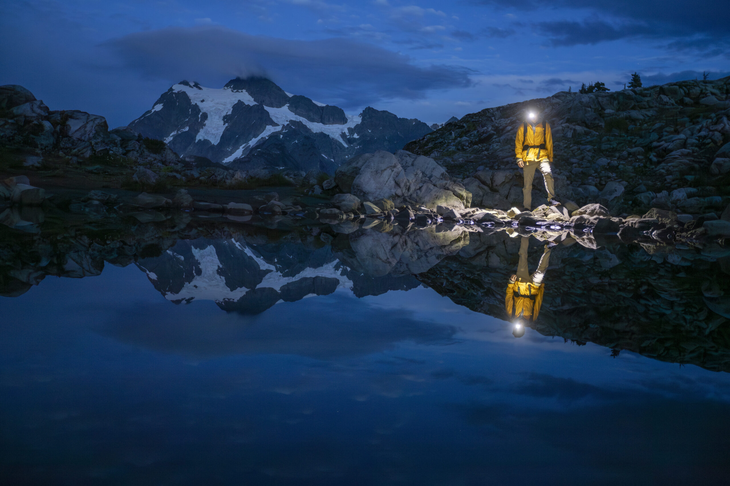
May 16–19, 2025
When aiming to visit every national park, sometimes a red-eye flight is an inevitable inconvenience. That’s why we find ourselves departing Denver International Airport at 11:59pm on a Friday night. After a 1 hour delay, the 3.5 hour flight lands us in Charlotte, North Carolina, for 2 hours before flying 1 hour down to Columbia, South Carolina. We land boots on the ground at 8:30am, pick up our rental car, and head straight to Congaree National Park.

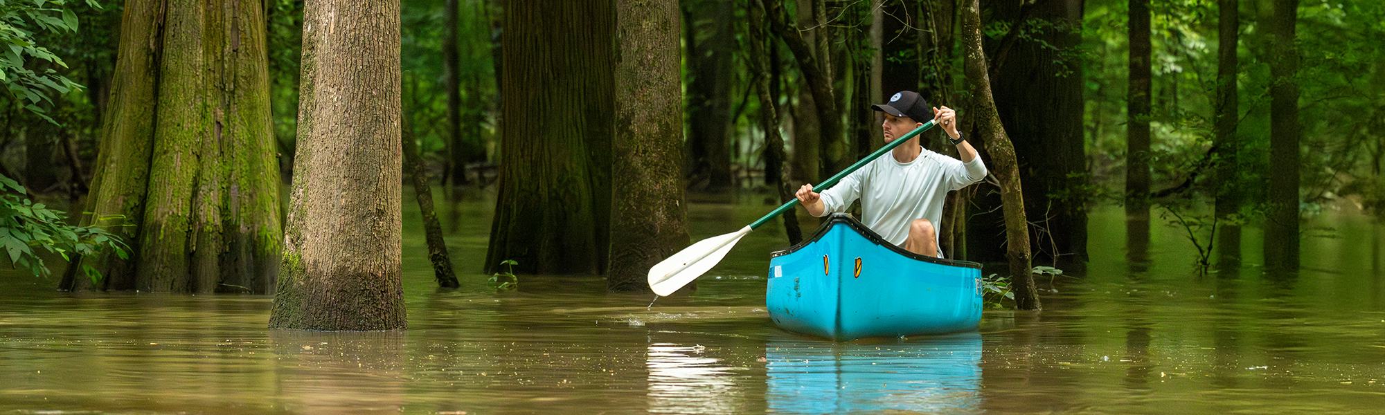
The week prior to our arrival saw heavy rainfall across the Congaree River valley resulting in a high flood state for the park. With an added 10 feet of water overflowing the banks of the river, much of the inland trails are submerged so our first stop is the Harry Hampton Visitor Center, to scope out the park’s accessibility. Flooding is not foreign to this region and the park is well equipped to handle the influx of water. Though many trails are inaccessible underwater, the high water actually creates new paths for kayaks and canoes through dense hardwood forests.
Realizing paddling is going to be most effective for exploring the saturated park, we drive back in town to Columbia and rent a two person canoe at River Runner Outdoor Center. With the canoe securely strapped to our Hyundai Kona rental car (no roof racks needed), we skip lunch and promptly return to the park to make the most of our day-long canoe rental. After dropping the vessel in the water at South Cedar Creek Landing, about four miles east of the visitor center, we let the lazy current carry us eastward into the park. With water levels so high, the entire forest is flooded. We keep the bluff in view to keep our bearing as we meander through bald cypress groves and around the trunks of tall water tupelos. Low lying branches offer fun obstacles to navigate in the slow riverway.

We spend 1.5 hours leisurely drifting downstream, soaking in the sights and sounds of the forest. The gentle ripple of hidden currents, the croaks of unseen tree frogs, the calls of distant barred owls draw us further and further downstream. However, to avoid a sizable late fee, we must return the canoe by 5 p.m. so we turn around and head back upstream uncertain of how long it will take to paddle back. What seemed like a gentle river proves to be unrelenting as we slowly make our way back up to the South Cedar Creek Landing by 4 p.m. This should allow us plenty of time to drive back to Columbia and drop of the canoe before closing time.
And this is good timing, because during late May, the park strategically closes down at 4:30 p.m. every day for it’s annual firefly festival, a lottery-based program for visitors to experience the migration of synchronous fireflies. 24,000 entries were accepted this year, but only 120 cars are permitted access to the visitor center grounds each night. However, because South Cedar Creek landing is on the border of the park, the parking lot is accessible while the visitor center grounds are closed. So even though we are not one of the lucky lottery winners, we return to South Cedar Creek after dinner around 8 p.m. to press our luck with a firefly show to ourselves.
To our surprise, we are in luck. Around 8:30 p.m. just after sunset pricks of light begin to blink in the underbrush near Cedar Creek. First one or two, then around 9 p.m. a whole chorus of flashing lightning bugs. Though they are not all in unison, they pair up and sync together here and there. Overall, 20–30 fireflies shine within eyesight along the banks of the creek. The light show is brief, lasting only 15–20 minutes, but for Colorado residents who rarely see fireflies this is enough to impress us. On the way to our hotel, in east Columbia, we marvel at the spectacle and its rarity, yet another gem of the National Park System we have the privilege of witnessing. That night we sleep soundly after a full day of travel and activity.

The next morning we wake and arrive at the Visitor Center at 9 a.m. to hike the trails, a little unsure of what is accessible given the flood waters. We pick the iconic Boardwalk Trail and dive in. The boardwalk winds us among the forest canopy before reaching down to the forest floor. As we descend, the trail before us plunges underwater. At first, with its gradual slope, the boards are only covered with a thin skim of water. Wearing Chacos, we feel brave enough to get our feet wet and continue on the path. However, we soon find the water ankle deep, then shin deep. At one point we find ourselves knee deep in the brown murky water. But the sight is incredible. What was once a barren forest floor just one week ago, now is a lake several feet deep from rainfall. We feel adventurous trudging out alone into the wetland with nothing but the feeling of a hidden boardwalk beneath us.
We come to a rest stop in the boardwalk—a half-sunken bench perched on a wooden platform. Here we catch a break from the wading and take in the surroundings. And good thing too. As we are standing on the bench out of the water, we spy a swimming cottonmouth snake gliding towards us. If bitten, these snakes pose a substantial threat as their venom is potentially fatal. In nothing but Chacos, we are grateful the snake swims past the bench and into the forest behind us. But that is enough to spook us and convince us to turn around. We don’t see any other wildlife on our way back to the elevated portion of the boardwalk. Feeling safer, we explore some of the other nearby trails unobstructed by flooding. Sims Trail is a wide gravel path leading down to the river from the visitor center. We are unable to venture more than half a mile before water turns us around, but in the silence and solitude of the trail, we spy two barred owls and many ebony jeweled damselflies flitting about. We return via Firefly Trail, a shortcut to the visitor center through dense Sweetgum and cypress trees.

Having explored the extent of the park, we take the afternoon off to rest and relax before giving South Cedar Creek another crack at fireflies. Tonight the sky is not dark as city lights reflect off the cloudy night sky. But to our delight, the fireflies are out in full swing. Like the previous night we are treated to a 20 minute show of dozens of lightning bugs. A good way to end a good day.
The morning of our last day comes quickly. We return to the Boardwalk trail to hopefully beat any crowds and catch some early morning birds. While forest birds dart about, we don’t see any waterfowl as we were hoping, but we notice the water level has substantially subsided from yesterday. Parts of the boardwalk that were underwater 24 hours ago are suddenly accessible and dry, so we give the boardwalk trail another go venturing further than yesterday—no snakes sightings, thankfully. The forest is quiet. Not a stirring is heard or scene save a few squirrels rummaging for pinecones and nuts through the flood debris.

We soak in our final moments in Congaree National Park—both literally and figuratively—before we return to our car, check out of our hotel, and make our way to the airport. The flight home is spent reminiscing about our stay in Congaree National Park. What seemed simply another forested national park, transformed into an immersive water adventure. From paddling the river to wading the boardwalk to capturing the firefly show, we leave Congaree altogether impressed with what a little water can do to transform our experience. Some may warn against exploring Congaree after a flood because activities are limited, but we leave especially grateful to have visited during flood season, for I am convinced this is what sets Congaree apart from any other park.

Looking for more?
To view more photos of this park and the rest of America’s 63 national parks, check out my ParkQuest project.